
Geography
Area:
total: 298 km²
land: 298 km²
water: 0 km²
Coastline: 644 km
Maritime claims: measured from claimed archipelagic baselines
territorial sea: 12 nmi (22.2 km; 13.8 mi)
contiguous zone: 24 nmi (44.4 km; 27.6 mi)
exclusive economic zone: 200 nmi (370.4 km; 230.2 mi)
Elevation extremes:
lowest point: Indian Ocean 0 m
highest point: unnamed location on Vilingili Island in the Addu Atoll 2.4 m (Maldives is the flattest
country in the world, i.e. they have the lowest high-point of any country in the world).
Natural resources: fish
Land use:
arable land: 10%
permanent crops: 10%
other: 80% (2011)
Irrigated land: 0 km2 (2003)
Total renewable water resources: 0.03 km3 (2011)
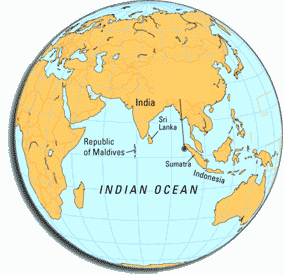
- Position: degree of lattitude: 07° 06'30" N to 00° 41'48" S and degree of longtitude: 72° 32'30" E to 73° 45'54" E westside of India and Sri Lanka.
- Range: in length approx. 750 km (from north to south) / in width approx. 120 km (from west to east)
- Land territory: 1,196 mostly deserted islands with a total area of approx. 298 km².
- The islands are in average 1.8 m above sea level.
- Distances: shortest distance to India: approx. 340 km and to Sri Lanka approx. 700 km.